Access maps and GPX files Find out more about GPX files and how to use them Filter [X] Dardanelle [X] Magnolia Cycling Motorcycling: Road Allison Altus Arkadelphia Arkansas City Ashdown Barton Batesville Bella Vista Bentonville Berryville Big Flat Bismarck Black Rock Bluff City Blytheville Bradley Briggsville Bull Shoals Calico Rock Camden Cass Centerville Cherokee Village Clarksville Clinton Corning Crossett Daisy Danville [X] Dardanelle Deer DeValls Bluff Dewitt Dyess El Dorado Emerson England Eureka Springs Fairfield Bay Fayetteville Fordyce Foreman Forrest City Fort Smith Fouke Fulton Garland City Gillett Glenwood Greenbrier Greers Ferry Hamburg Hardy Harrisburg Harrison Havana Heber Springs Helena-West Helena Hope Hot Springs Huntsville Jacksonville Jasper Jonesboro Keo Kingsland Kirby Lake View Lake Village Lepanto Leslie Little Rock Lynn Magazine [X] Magnolia Mammoth Spring Marianna Marion Marked Tree Marshall Marvell Maynard McGehee McNeil Mena Morrilton Mountain Home Mountain Pine Mountain View Mount Ida Murfreesboro Nashville Natural Dam Newport Norfork Norman North Little Rock Oark Ola Oppelo Ozark Paragould Paris Parks Perryville Piggott Pine Bluff Pine Ridge Pocahontas Ponca Powhatan Prairie Grove Prescott Prim Ravenden Springs Rogers Rohwer Roland Russellville Saratoga Scott Smithville Springdale St. Paul Star City Story Stuttgart Subiaco Taylor Texarkana Tillar Timbo Tyronza Van Buren Village Waldron Walnut Ridge Warren Waveland West Fork West Memphis White Hall Wilson Winchester Winslow Wye Wynne Yellville Facet Grid Trails: Cities Central Lower Delta North Central Northwest Southwest Mount Magazine/Wine Country Loop Switchbacks, tight curves, and ear-popping elevation changes View Route on Map Download GPX Mount Nebo From the intersection at Hwy. 64 and Hwy. 155, it's about three miles of rolling hills and one wall of work between you and the top of Mount Nebo. Rising 1,350 feet, it's a very challenging ascent with several sharp switchbacks. View Route on Map Download GPX Arkansas High Country Route This 1,172-mile mixed-surface route has three interlocking loops around the state. Southwest Trail A blissful journey through vast forests and flat, fertile farmland View Route on Map Download GPX Hamburg Haul Wind through vast southern forests on lazy, sweeping curves View Route on Map Download GPX Tour of Columbia County This route passes by two of the oldest country stores in the tri state region. View Route on Map Download GPX El Dorado to Magnolia This route follows quiet and rolling county roads through lush pine timberlands. View Route on Map Download GPX
Mount Magazine/Wine Country Loop Switchbacks, tight curves, and ear-popping elevation changes View Route on Map Download GPX
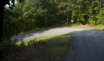
Mount Nebo From the intersection at Hwy. 64 and Hwy. 155, it's about three miles of rolling hills and one wall of work between you and the top of Mount Nebo. Rising 1,350 feet, it's a very challenging ascent with several sharp switchbacks. View Route on Map Download GPX
Arkansas High Country Route This 1,172-mile mixed-surface route has three interlocking loops around the state.
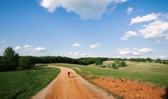
Southwest Trail A blissful journey through vast forests and flat, fertile farmland View Route on Map Download GPX
Hamburg Haul Wind through vast southern forests on lazy, sweeping curves View Route on Map Download GPX
Tour of Columbia County This route passes by two of the oldest country stores in the tri state region. View Route on Map Download GPX
El Dorado to Magnolia This route follows quiet and rolling county roads through lush pine timberlands. View Route on Map Download GPX