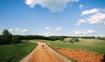
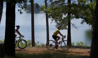
Access maps and GPX files Find out more about GPX files and how to use them Filter [X] Fayetteville [X] Mountain Pine [X] Southwest Cycling Arkadelphia Ashdown Bentonville Bismarck Bluff City Bradley Camden Daisy Dardanelle El Dorado Emerson Eureka Springs [X] Fayetteville Fordyce Foreman Fouke Fulton Garland City Glenwood Harrison Havana Hope Hot Springs Jasper Kingsland Kirby Leslie Little Rock Magazine Magnolia Marshall McNeil Mena [X] Mountain Pine Mount Ida Murfreesboro Nashville Norman Ola Paris Parks Pine Ridge Ponca Prescott Roland Russellville Saratoga Springdale Story Taylor Texarkana Village Waldron Wye Facet Grid Trails: Cities [X] Southwest Central North Central Northwest Arkansas High Country Route This 1,172-mile mixed-surface route has three interlocking loops around the state. Four-Lake Loop This moderate ride allows you to stop and camp at four great Arkansas State Parks. At its max, the loop is more than 200 miles and takes you by Lake Ouachita, Lake Greeson, DeGray Lake and Lake Hamilton. View Route on Map Download GPX
Arkansas High Country Route This 1,172-mile mixed-surface route has three interlocking loops around the state.
Four-Lake Loop This moderate ride allows you to stop and camp at four great Arkansas State Parks. At its max, the loop is more than 200 miles and takes you by Lake Ouachita, Lake Greeson, DeGray Lake and Lake Hamilton. View Route on Map Download GPX