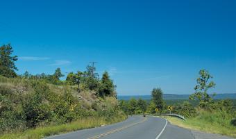
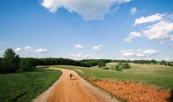
Access maps and GPX files Find out more about GPX files and how to use them Filter [X] Greers Ferry [X] Jasper [X] Central Cycling Motorcycling: Road Bentonville Centerville Clinton Dardanelle DeValls Bluff England Eureka Springs Fairfield Bay Fayetteville [X] Greers Ferry Heber Springs Hot Springs Jacksonville [X] Jasper Keo Leslie Little Rock Marion Marshall Morrilton Mount Ida North Little Rock Ola Oppelo Perryville Pine Bluff Ponca Roland Russellville Scott Springdale Stuttgart West Memphis Wye Facet Grid Trails: Cities [X] Central North Central Northwest Southwest Greers Ferry Loop to Pinnacle Mountain A pleasant run through gorgeous pastoral scenery in the Ouachita foothills View Route on Map Download GPX Arkansas High Country Route This 1,172-mile mixed-surface route has three interlocking loops around the state.
Greers Ferry Loop to Pinnacle Mountain A pleasant run through gorgeous pastoral scenery in the Ouachita foothills View Route on Map Download GPX
Arkansas High Country Route This 1,172-mile mixed-surface route has three interlocking loops around the state.