Access maps and GPX files Find out more about GPX files and how to use them Filter [X] Leslie [X] Perryville [X] Central Cycling Motorcycling: Road Bentonville Centerville Clinton Dardanelle DeValls Bluff England Eureka Springs Fairfield Bay Fayetteville Greers Ferry Heber Springs Hot Springs Jacksonville Jasper Keo [X] Leslie Little Rock Marion Marshall Morrilton Mount Ida North Little Rock Ola Oppelo [X] Perryville Pine Bluff Ponca Roland Russellville Scott Springdale Stuttgart West Memphis Wye Facet Grid Trails: Cities [X] Central North Central Northwest Southwest Arkansas High Country Route This 1,172-mile mixed-surface route has three interlocking loops around the state. Greers Ferry Loop to Pinnacle Mountain A pleasant run through gorgeous pastoral scenery in the Ouachita foothills View Route on Map Download GPX Petit Jean Mountain Climb Plenty of tight turns to thrill you on the way to Arkansas' first state park View Route on Map Download GPX
Arkansas High Country Route This 1,172-mile mixed-surface route has three interlocking loops around the state.
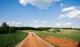
Greers Ferry Loop to Pinnacle Mountain A pleasant run through gorgeous pastoral scenery in the Ouachita foothills View Route on Map Download GPX
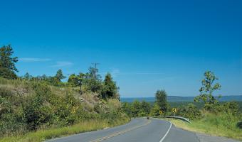
Petit Jean Mountain Climb Plenty of tight turns to thrill you on the way to Arkansas' first state park View Route on Map Download GPX