Outdoor Experiences

1 /
Feel the Rush of Arkansas Outdoors
From first-time adventurers to seasoned thrill-seekers, Arkansas offers outdoor challenges that are exciting, accessible and unforgettable.
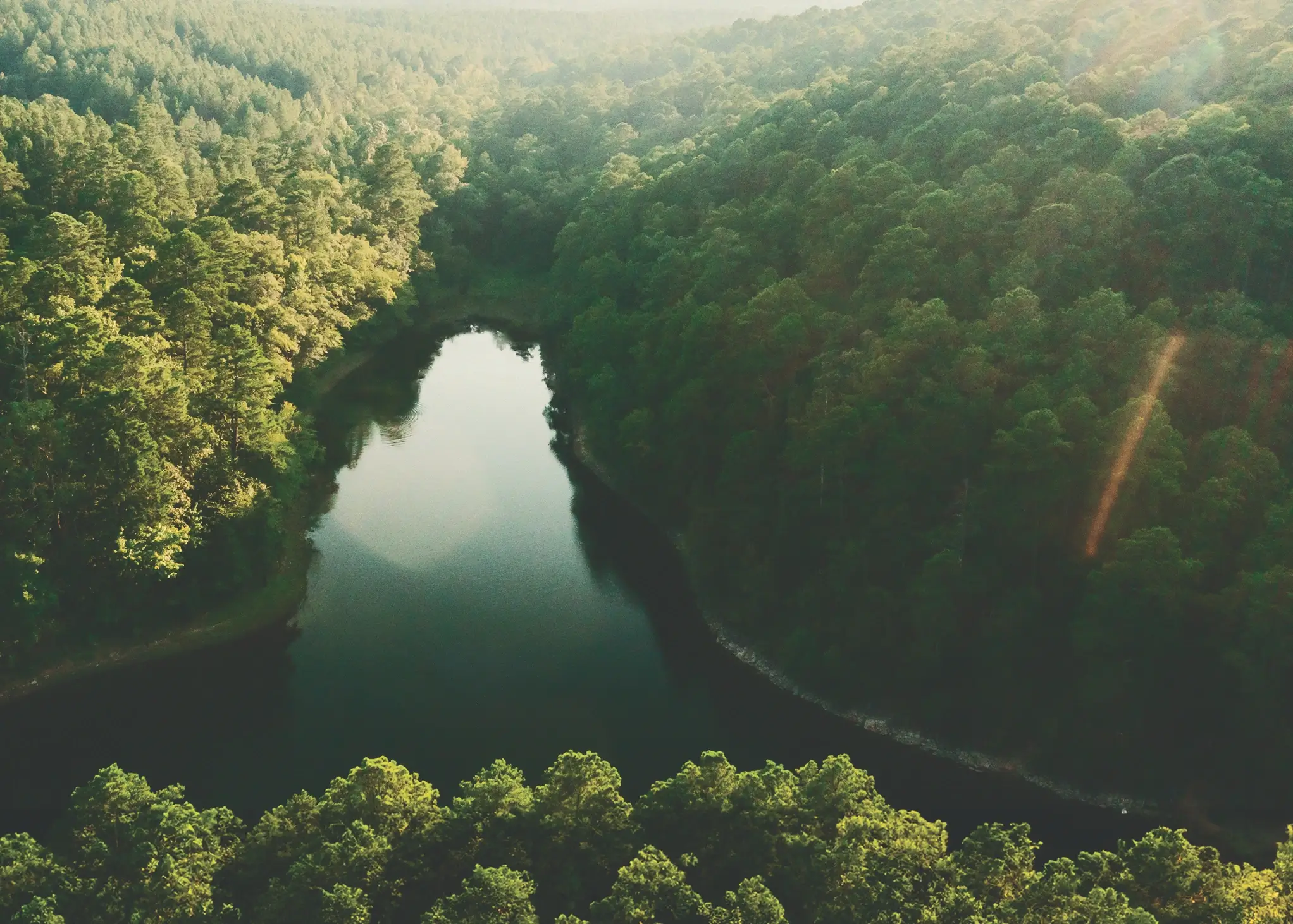
Arkansas is made for adventure, with landscapes that invite you to test your limits or just try something new. In the Ozark and Ouachita Mountains, the Monument Trails at Mount Nebo and Devil’s Den state parks take bikers along ridgelines, through winding switchbacks and down fast, flowy descents. Gravel riders trade mountain views for wide-open stretches on the Delta Heritage Trail, while climbers head to Petit Jean State Park, Horseshoe Canyon Ranch, Sam’s Throne and Mount Magazine to grip sandstone walls and earn big sky views.
If speed is your thrill, the Wolf Pen Gap Trail System in Mena offers 40 miles of rugged ATV tracks through the pines. Racetracks across the state keep hearts pounding with drag racing, dirt ovals and motorcycle runs. For the ultimate rush, leap from a plane on a tandem skydive or launch a hang glider from Mount Magazine and watch valleys unfold beneath your feet.
Water brings its own excitement. The Cossatot River turns wild with Class IV–V rapids after heavy rains, while the Spring River flows cold and clear all year, perfect for rafting or kayaking.
Families can find their own adrenaline high on zip line courses in Hot Springs, Ponca and Eureka Springs, where canopy tours mix fast cables with rope bridges and forest views.
Whether it’s your first time on a trail or your hundredth day on the water, Arkansas makes it easy to dive in. Outfitters and guides are ready to help beginners gear up, while seasoned adventurers will discover challenges worth bragging about. From mountaintop to riverbank, Arkansas is the place to feel the rush of the outdoors.


Welcome to Arkansas
Arkansas is a state of six distinct regions. Every corner of The Natural State has its own character and story, from the rolling hills and clear rivers of the Ozarks to the rich cultural heritage of the Delta. Central Arkansas adds lakes and city energy, while the Ouachita Mountains deliver scenic drives, forested peaks and inviting thermal springs. The River Valley offers expansive views from its mountaintops to the shores of the Arkansas River, while the Timberlands pair towering pines with oil-boom history and presidential roots.
The Ozarks
Arkansas’ Wild Side Shines in the Ozarks
Nature worked wonders in the Ozark Mountains, carving a landscape of soaring bluffs, hidden caverns, wooded valleys and rolling ridgelines that now set the stage for some of Arkansas' most exciting outdoor adventures. Lakes, rivers and the legendary fly fishing waters of the White and Little Red draw anglers and paddlers from across the country. More than 40 miles of the Razorback Greenway link parks, downtowns, breweries, art museums, live music and eateries. Spend a day here with a casual bike ride from a hotel to a James Beard-nominated restaurant, then world-class mountain biking on OZ Trails. Watching the sun rise from a cabin overlooking the Buffalo National River, then fade to dusk as elk bugle in nearby fields. Exploring Blanchard Springs Caverns by day and listening to live music on an Ozark town square at night. From college towns to lake towns to river towns, the Ozarks prove that urban energy and outdoor culture share the same stage.
The Timberlands
From Pine Forests to Presidential Roots
From the pine forests of El Dorado to the historic streets of Hope and Camden, the Timberlands region tells Arkansas stories in bold ways. Walk through Smackover’s Arkansas Museum of Natural Resources to learn how the oil boom transformed the state, then step into El Dorado’s lively downtown, where historic buildings now house shops and restaurants. History buffs can head to Historic Washington State Park to see where a Bowie knife was first forged, or tour President Bill Clinton’s boyhood home in Hope.
The Delta
Where Blues, Barbecue and History Run Deep
The Arkansas Delta stretches along the Mississippi River, where farmland, river towns and outdoor traditions define the region. Waterfowlers come for renowned duck hunting, while Crowley’s Ridge adds scenic overlooks and hiking trails that break up the flat landscape. In Helena, the Delta Cultural Center broadcasts King Biscuit Time, and each October the King Biscuit Blues Festival draws music lovers from across the country. From riverfront stops to Marianna’s James Beard-recognized Jones Bar-B-Q Diner, the Delta pairs blues, barbecue and outdoor recreation in one distinctive corner of Arkansas.
Capital
The Heart of The Natural State
The Capital Region of Arkansas shows off the full Arkansas experience with the rich culture of the state’s capital city surrounded by natural beauty. Packed with arts, dining, breweries, distilleries and entertainment venues, both Little Rock and North Little Rock have walkable downtowns with access to riverfront trails for hiking and biking. The Big Dam Bridge, built for walkers and cyclists, spans the Arkansas River and links the cities. The surrounding landscape shifts from river bottoms to forested ridges within minutes, leading to adventure at places like Pinnacle Mountain State Park. Farther out, paddlers find calm water on the Saline River and Lake Maumelle, while anglers chase bass along shaded banks. College-town Conway adds boutiques and cafes, while tiny Scott surprises with a prehistoric mound site. Here, city life and outdoor fun sit closer together than you'd expect.
River Valley
Mountains Above, Rivers Below
In the Arkansas River Valley, flat-topped mountains, rivers and wineries invite exploration. At Petit Jean State Park, you can climb sandstone formations on the Seven Hollows Trail or step into Rock House Cave to see prehistoric rock art. Mount Nebo State Park has become a bucket-list destination for mountain bikers on the Monument Trails, while Mount Magazine State Park stands as the state’s highest point with views that stretch for miles. Fish the Arkansas River, camp and swim at Blue Mountain Lake or tour a winery. The River Valley is made for adventure.
The Ouachitas
Ancient Mountains, Modern Adventures
The Ouachita Mountains deliver some of Arkansas’ most varied adventures, from thru-hiking the 223-mile Ouachita National Recreation Trail to soaking in the thermal waters of Hot Springs National Park. Camping, paddling, boating, mountain biking and fishing all thrive here. Lake Ouachita, one of the cleanest lakes in the country, anchors the region's water recreation. Between crystal digging near Mount Ida, mountain drives on the Talimena National Scenic Byway, and spa time in Hot Springs, the Ouachitas balance outdoor adventure with restoration.