Road Cycling Trails Find out more about GPX files and how to use them Filter [X] Eureka Springs [X] West Fork Cycling Arkansas City Barton Batesville Bentonville Bismarck Daisy Dardanelle Dyess El Dorado Emerson [X] Eureka Springs Fayetteville Harrisburg Harrison Havana Helena-West Helena Hot Springs Jasper Keo Kirby Lake View Lepanto Leslie Little Rock Magazine Magnolia Marion Marked Tree Marshall McGehee McNeil Mena Morrilton Mountain Pine Mount Ida Murfreesboro Norman North Little Rock Paris Ponca Rogers Rohwer Roland Russellville Scott Springdale Story Tillar Tyronza Village Walnut Ridge [X] West Fork West Memphis White Hall Wilson Winslow Wye Facet Grid Trails: Cities Central North Central Northwest Southwest Arkansas High Country Route This 1,172-mile mixed-surface route has three interlocking loops around the state. Winslow Death March Loop With its steep ramps, multiple switchbacks, fast descents and glorious views, this difficult route is a proper introduction to the Ozarks View Route on Map Download GPX
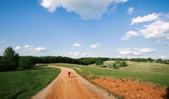
Arkansas High Country Route This 1,172-mile mixed-surface route has three interlocking loops around the state.
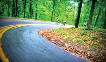
Winslow Death March Loop With its steep ramps, multiple switchbacks, fast descents and glorious views, this difficult route is a proper introduction to the Ozarks View Route on Map Download GPX