Skip to content
Menu
  • Outdoor Recreation
  • History & Culture
  • Culinary Adventures
  • Music & Festivals
  • Fishing & Hunting
  • Events Calendar
  • Outdoor Recreation
  • History & Culture
  • Culinary Adventures
  • Music & Festivals
  • Fishing & Hunting
  • Events Calendar

Road Cycling Trails

Find out more about GPX files and how to use them

Filter
  • [X] Lepanto
  • [X] Murfreesboro
  • Cycling
  • Arkansas City
  • Barton
  • Batesville
  • Bentonville
  • Bismarck
  • Daisy
  • Dardanelle
  • Dyess
  • El Dorado
  • Emerson
  • Eureka Springs
  • Fayetteville
  • Harrisburg
  • Harrison
  • Havana
  • Helena-West Helena
  • Hot Springs
  • Jasper
  • Keo
  • Kirby
  • Lake View
  • [X] Lepanto
  • Leslie
  • Little Rock
  • Magazine
  • Magnolia
  • Marion
  • Marked Tree
  • Marshall
  • McGehee
  • McNeil
  • Mena
  • Morrilton
  • Mountain Pine
  • Mount Ida
  • [X] Murfreesboro
  • Norman
  • North Little Rock
  • Paris
  • Ponca
  • Rogers
  • Rohwer
  • Roland
  • Russellville
  • Scott
  • Springdale
  • Story
  • Tillar
  • Tyronza
  • Village
  • Walnut Ridge
  • West Fork
  • West Memphis
  • White Hall
  • Wilson
  • Winslow
  • Wye
  • Southwest
  • Upper Delta
Sunken Lands Cultural Roadway

Sunken Lands Cultural Roadway

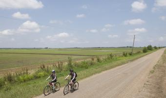
Bordered by two scenic byways - Crowley's Ridge Parkway and the Great River Road - this route is used for the annual Tour duh Sunken Lands Cultural Bike Ride in November
View Route on Map
Download GPX
Four-Lake Loop

Four-Lake Loop

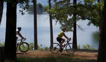
This moderate ride allows you to stop and camp at four great Arkansas State Parks. At its max, the loop is more than 200 miles and takes you by Lake Ouachita, Lake Greeson, DeGray Lake and Lake Hamilton.
View Route on Map
Download GPX

Sign Up for our Newsletter

We care about your data. Read our privacy policy.

  • Arkansas State Parks
  • Media Inquires
  • Industry Resources
Privacy Policy

©Copyright 2025 Arkansas Department of Parks, Heritage, and Tourism