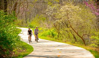
Road Cycling Trails Find out more about GPX files and how to use them Filter [X] Springdale [X] Northwest Cycling Bentonville Dardanelle Eureka Springs Fayetteville Havana Hot Springs Jasper Leslie Little Rock Magazine Marshall Mena Mount Ida Paris Ponca Rogers Roland Russellville [X] Springdale West Fork Winslow Wye Facet Grid Trails: Cities [X] Northwest Central North Central Southwest Razorback Regional Greenway Planned for more than 20 years, the Razorback Regional Greenway is now a reality. This 36-mile, primarily off-road, shared-use trail connects six different downtowns, arts and entertainment districts, shopping, and the University of Arkansas campus. View Route on Map Download GPX Arkansas High Country Route This 1,172-mile mixed-surface route has three interlocking loops around the state.
Razorback Regional Greenway Planned for more than 20 years, the Razorback Regional Greenway is now a reality. This 36-mile, primarily off-road, shared-use trail connects six different downtowns, arts and entertainment districts, shopping, and the University of Arkansas campus. View Route on Map Download GPX
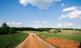
Arkansas High Country Route This 1,172-mile mixed-surface route has three interlocking loops around the state.